Question 1 of 10
A barometer is an instrument used to measure:
A air pressure
B relative humidity
C wind speed
D air temperature
Explanation
A barometer measures atmospheric (air) pressure.
Question 2 of 10
The shape of the orbits of the planets around the Sun is best described as:
A a square
B a perfect circle
C an ellipse
D a straight line
Explanation
Planetary orbits are ellipses (slightly elongated circles), with the Sun at one focus.
Question 3 of 10
About how long does it take Earth to ROTATE once on its axis?
A about one month
B 24 hours
C 12 hours
D 365 days
Explanation
One rotation of Earth on its axis takes about 24 hours, producing day and night.
Question 4 of 10
As the temperature of air increases, the maximum amount of water vapor the air can hold:
A decreases
B stays the same
C drops to zero
D increases
Explanation
Warmer air can hold more water vapor before becoming saturated.
Question 5 of 10
On a topographic map, contour lines that are spaced very close together indicate:
A a gentle slope
B a steep slope
C perfectly flat land
D a body of water
Explanation
Closely spaced contour lines mean elevation changes rapidly over a short distance — a steep slope.
Question 6 of 10
The apparent daily motion of the Sun across the sky (rising in the east and setting in the west) is caused by:
A the Sun orbiting Earth
B Earth's rotation on its axis
C the gravitational pull of the Moon
D Earth's revolution around the Sun
Explanation
Earth rotates west-to-east on its axis, making the Sun appear to move east-to-west each day.
Question 7 of 10
As altitude increases within the lower atmosphere, air pressure generally:
A doubles
B stays constant
C increases
D decreases
Explanation
There is less air above you at higher altitudes, so air pressure decreases.
Question 8 of 10
Using the labeled contour lines on the map, what is the contour interval? 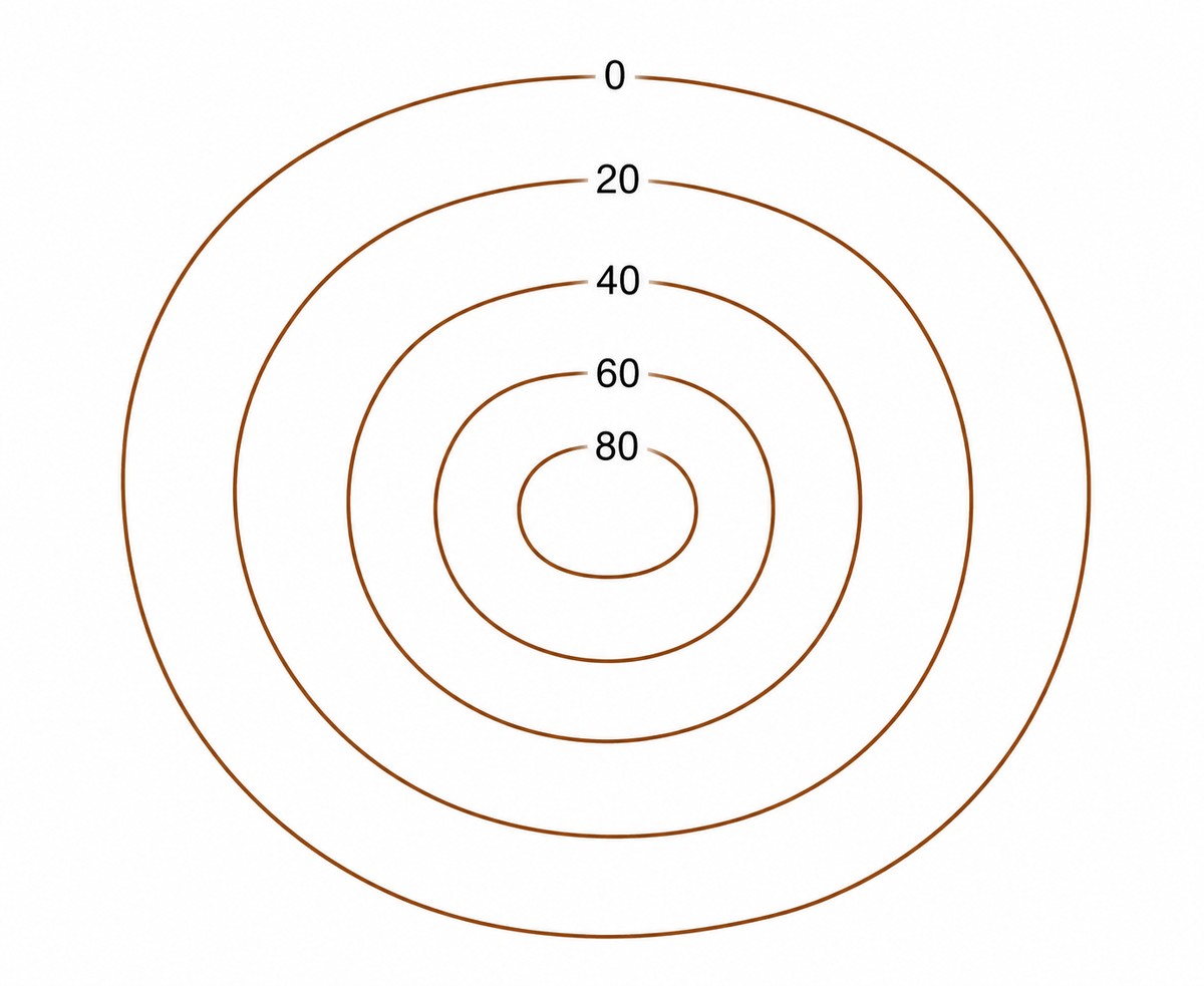
A 40 feet
B 20 feet
C 10 feet
D 80 feet
Explanation
The contour interval is the elevation change between adjacent lines: 20 − 0 = 20.
Question 9 of 10
Approximately how long does one complete revolution of Earth around the Sun take?
A 30 days
B 365¼ days (one year)
C 27.3 days
D 24 hours
Explanation
One revolution (orbit) of Earth around the Sun takes about 365¼ days — one year.
Question 10 of 10
The topographic map shows four locations labeled A, B, C, and D. At which location is the land surface STEEPEST? 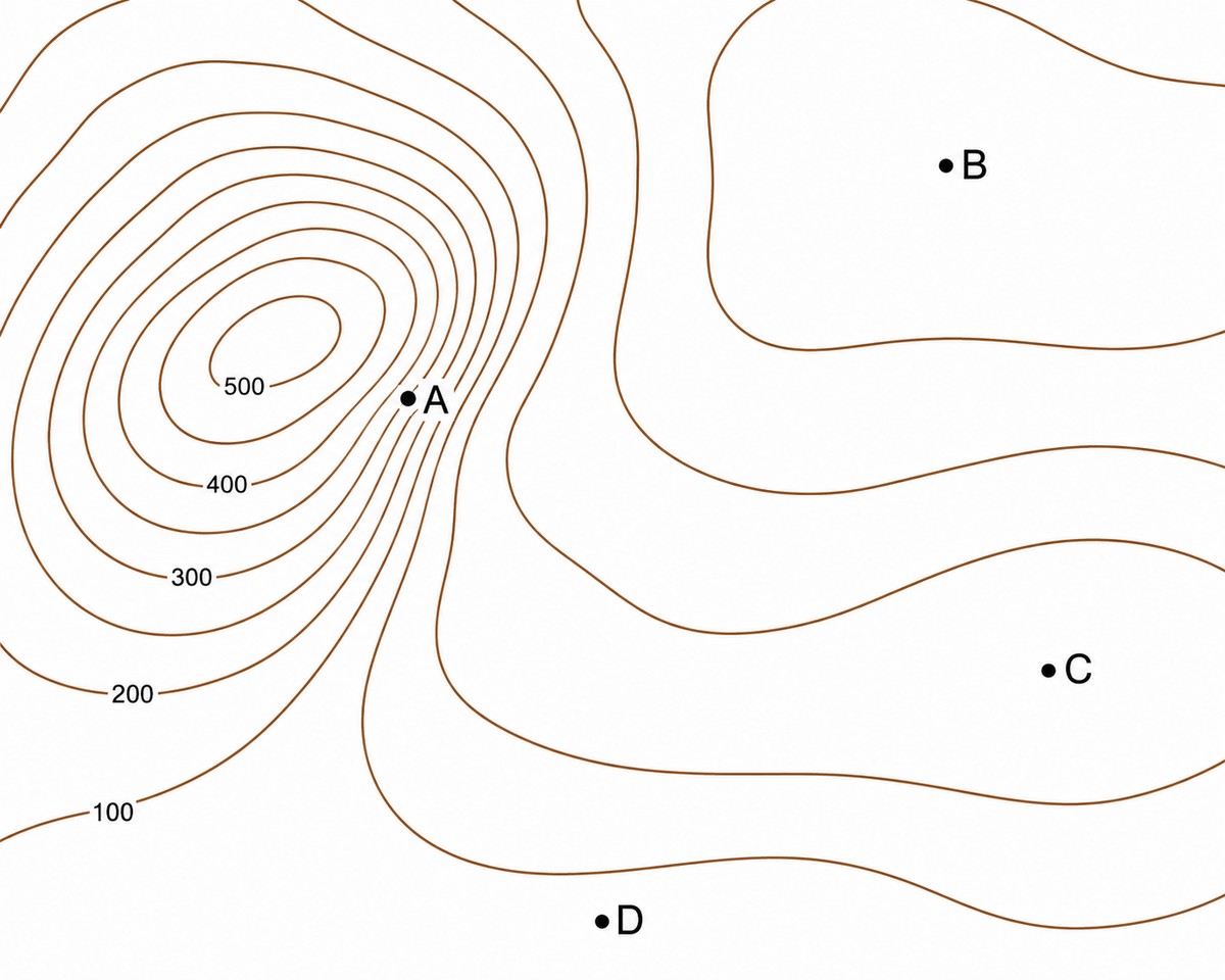
A C
B D
C A
D B
Explanation
Contour lines bunched close together show a steep slope (large elevation change over a short horizontal distance). They are closest at point A.