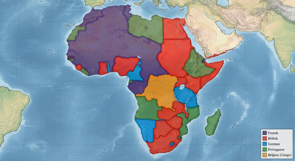
The map below shows a simplified version of European colonial claims in Africa around 1914. According to the map, which colonial power’s territory is surrounded on multiple sides by a single other power’s claim, rather than bordering several different claimants?
ABelgian Congo, boxed in by German claims on most sides
BBritish territory, boxed in by Portuguese claims on most sides
CFrench territory, boxed in by British claims on most sides
DPortuguese territory, boxed in by Belgian claims on most sides
Explanation
On the map, the small orange Belgian Congo claim sits nested almost entirely inside the larger green German claim, sharing borders with it on most sides — a landlocked claim boxed in by one larger neighbor. The British (blue) and French (red) claims sit along the map’s northern and western edges, each bordering several different claimants rather than a single one, and Portuguese territory (purple) sits along the eastern edge bordering German territory, not Belgian territory as the distractor claims.