Colonial Foundations: The Three Regions and Why Geography Mattered
The 13 American colonies fell into three distinct regions — New England, Middle, Southern — each with a different climate, geography, and economy. Master these regions and the geographic features that shaped settlement.
Geography first, history second
Before you can understand the American Revolution or the Civil War, you have to understand where Americans were settling and why. Geography determined what colonists could grow, how they made money, and even what kind of society they built. The Texas U.S. History CBE asks at least one question per exam about the three colonial regions — and it's almost always free points if you know the basics.
The three colonial regions
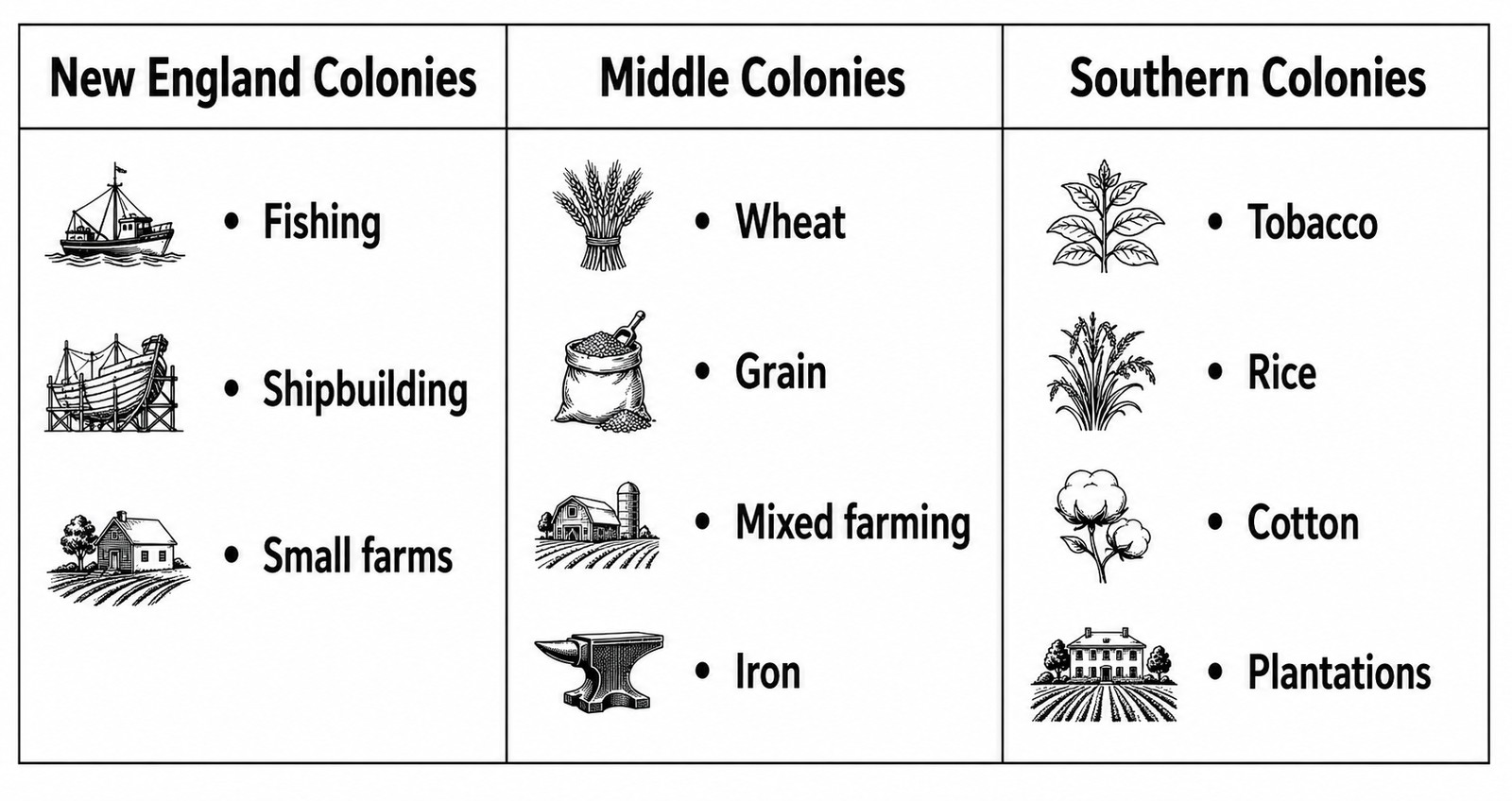
- New England (Massachusetts, Connecticut, Rhode Island, New Hampshire) — rocky soil, cold winters → fishing, shipbuilding, small farms. Towns built around Puritan churches.
- Middle Colonies (New York, Pennsylvania, New Jersey, Delaware) — fertile soil, mild climate → wheat, grain, mixed farming, iron. Nicknamed "the Breadbasket." Religiously diverse.
- Southern Colonies (Virginia, Maryland, the Carolinas, Georgia) — warm climate, long growing season → tobacco, rice, indigo, later cotton. Large plantations worked by enslaved labor.
The mountain wall: Appalachians as barrier
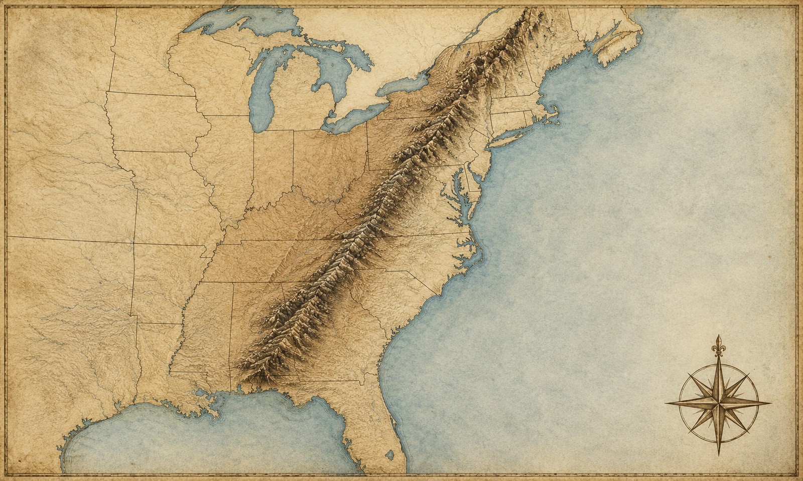
Look at any colonial-era map and you'll notice settlement is squeezed into a narrow strip along the Atlantic coast. That's because the Appalachian Mountains ran like a wall north-to-south, blocking westward expansion until roads and railroads finally pierced them. Other geographic features that shaped early America:
- Atlantic Coastal Plain — flat, fertile, easy to settle → most early colonies hugged this band.
- Mississippi River system — would later become the highway of westward expansion (after 1803 Louisiana Purchase opened it up).
- Great Lakes — natural barrier with Canada and a future shipping artery.